
Latest market information from Komatsu gives details of a new satellite positioning technology capable of being fitted to their forest equipment.
Described by Komatsu as “bringing opportunities for new, smarter ways of working” thanks to satellite positioning technology, it “can show a machine’s position to within just a few centimetres” with a negligible error margin.
Distributed in Ireland and Northern Ireland by McHale Plant Sales of Birdhill and Rathcoole, this latest gear (premiered at the Swedish Forestry Expo) uses several satellite systems – including the commissioning of Galileo, the European GNSS system – to determine precise positions with precision reduced from several meters to a few centimetres.
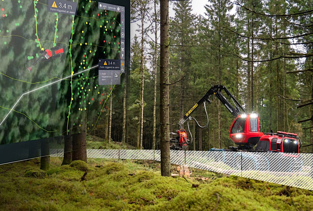
As a result, operators can mark exact boundaries with a new ‘geofencing’ feature – a digital fence that is added when planning an area to mark out ground to be harvested from protected areas such as a neighbour’s trees, ancient monuments or charcoal pile remains.
A feature that Komatsu says: ‘provides greater peace of mind for forest owners and operators alike’, its other advantages include better mapping, more accurate machine route plotting, and greater operational savings.
Eliminating the need to walk the forest and mark trees for felling, boundaries and specific trees can be marked digitally, based on map data collected from drones or scanning.
In addition, the exact position of each felled log is available with greater precision – beneficial in the dark or when ground is covered with snow – making it easier to see the assortment found in each log pile or at the roadside.
Described by McHale Plant Sales director, Denis McGrath as: “an ‘increased productivity and reduced fuel consumption’ development, its many functions includes a stem code visualisation feature that brings technology to bear when making biodiversity considerations, when following directives, and when tracking high stumps on the forest floor.”